Rivers in Washington State have started to overflow their banks and flood streets and home as a “pineapple express’ atmospheric river storm continues to dump heavy rain in the Pacific Northwest.
SEATTLE – Heavy rain overnight has already triggered some areas of across western and as an storm known as a drenches the Pacific into its second day Tuesday.
Multiple rivers across the region are on Flood Warnings and some rivers near populated areas in the foothills of Western Washington are forecast to near or reach major flood stage by midweek. Already, as much as 4-8 inches of rain have fallen in the mountains, and more is on the way.
Video recorded in Granite Falls, Washington, shows floodwaters covering roads and flowing from homes after the Stillaguamish River overflowed its banks on Tuesday.
A Pineapple Express is when the jet stream dips to the south into the tropical Pacific near , gathers warm, moist air and carries it across the ocean where it dumps heavy rain in either the Pacific Northwest or .
And the air in Washington is indeed warm. recorded a temperature of 59 degrees early Tuesday morning, which broke its old record of 58 degrees. , Washington, hit 63 degrees on Tuesday morning, making it its second-warmest December temperature on record. Snow levels are near 10,000 feet.
Several more inches of rain Tuesday before drying out Tuesday night
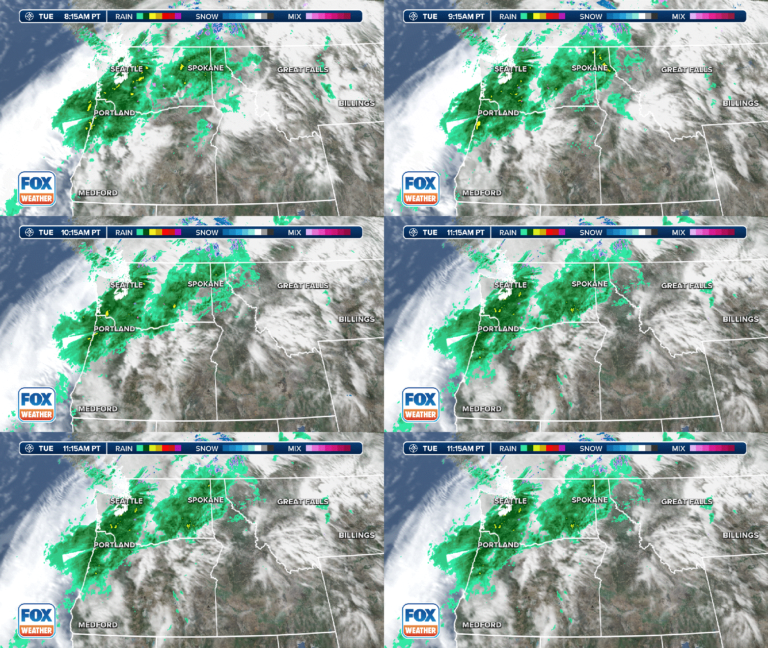
(FOX Weather)
The is expected to remain heavy into later Tuesday before finally letting up Tuesday evening as the band of moisture slowly pushes inland, but the stage has been set for significant river flooding.
Heavy rain on Tuesday morning led to standing water on several Seattle-area highways and roads, including Interstate 5. An off-ramp in North Seattle was flooded and closed for about an hour because of the flooding, according to the Washington Department of Transportation (WSDOT).
And the Snohomish County Sheriff’s Office shared a photo of a car that had become stranded in high water in , Washington, where nearly 6 inches of rain have fallen. The driver of the stranded vehicle was safely rescued.
The Washington State Patrol said on X that troopers have responded to more than a dozen crashes since midnight in Snohomish County, with multiple areas with standing water.
According to the , the county’s Flood Warning Center was opened to monitor conditions and and has warned that road closures are possible after the Snoqualmie River rose to a Phase 3 flood level.
According to the blog, the river’s three forks was recorded flowing at 20,670 cubic feet per second (CFS) which surpassed the Phase 3 flood alert threshold of 20,000 CFS.
“At these flows, we could expect to see flooding across the entire Snoqualmie Valley,” the blog said. “Roads that could overtop include the Fall City – Carnation Road, portions of West Snoqualmie River Road, Northeast Tolt Hill Road, Novelty Flats Road and others.”
Video recorded in Granite Falls, Washington, shows the Stillaguamish River overflowing its banks and starting to flood roads and homes in the area.
These are all signs that flooding is starting to become a larger problem across the region.
The FOX Forecast Center says that the combination of several inches of rain on top of the 2-4 feet of snow on the ground in the Cascades and Olympics from winter storms over the weekend is resulting in extensive runoff. Numerous rivers, creeks and streams are expected to reach flood stage – with major flooding possible in some spots.
Water levels are expected to climb significantly on Tuesday and will crest either late Tuesday night or Wednesday.
An animated image showing the Skagit River hydrograph at Mt. Vernon, Washington and the Snoqualmie River hydrograph at Carnation, Washington.
(FOX Weather)
Moderate to major flooding is expected along the Skagit, Snohomish, Snoqualmie and Skokomish rivers in Western Washington, and communities along those rivers should prepare for the possibility of flooded roads and water creeping into buildings.
is expected to crest at 35.47 feet on Thursday. The is expected to crest at 58.55 feet on Wednesday. Both those crests are considered major flood stage.
Flood Watches remain in effect for much of the Northwest
Forecast rain totals through Wednesday, December 6, 2023.
several inches of rain have already fallen in the region and up to 5 inches of additional rain is possible over the Olympics, 2-4 inches over the Cascades, 1-2 along the coast and 1-2 over the interior lowlands by late Tuesday.
This will be on top of the already impressive rainfall totals reported in the region over the past 24 hours.
Top rainfall totals in Washington as of Dec. 5, 2023
The NWS says Olympic recorded 8.67 inches of rain. and Granite Falls, which both are near the foothills of the Cascades, picked up several inches of rain. Duvall recorded 7.12 inches while Granite Falls reported 5.87 inches. Skykomish, in the heart of the Cascades along Stevens Pass, was just over 7 inches and counting.
Flood Alerts in effect in Washington, Oregon and California through Thursday, December 7, 2023.
(FOX Weather)
The Flood Watches have covered much of western Washington and Oregon for days, but have expanded to the south to include portions of Northern California, including , through Thursday.
Flood Watches include the cities of , Seattle and in Washington. In Oregon, the cities of , , and are included in the Flood Watch.
The flash flood threat on Wednesday and Thursday.
(FOX Weather)
The bulk of the heavy precipitation is expected to wind down as we head into Wednesday.
However, the flood risk will continue throughout the day as the copious amounts of water continue to flow downstream. More rain is in the forecast later in the week but snow levels will return to more typical December levels, mitigating any future flood threat.