The FOX Forecast Center is keeping its eyes on a developing storm system that could bring severe thunderstorms, including tornadoes, to the South, a burst of heavy snow in the Midwest and heavy rain and whipping winds along the East Coast from the mid-Atlantic to the Northeast.
Millions of Americans across the eastern half of the could be in for a messy weekend as computer models start to come into agreement that a developing storm system could produce heavy , and heavy rain in a matter of days.
The FOX Forecast Center stresses that the system is still several days away, and some changes are likely. It usually isn’t until around 72 hours that the scope of a severe weather outbreak comes into better view.
The setup for a potentially potent storm this weekend.
(FOX Weather)
Computer models show a trough of low pressure diving out of the western U.S. later this week, which will then trigger the development of a surface low over the central Plains on Friday.
Where that surface low develops will be key in determining which type of falls over an area – whether it be rain or .
Severe weather threat in the South
(FOX Weather)
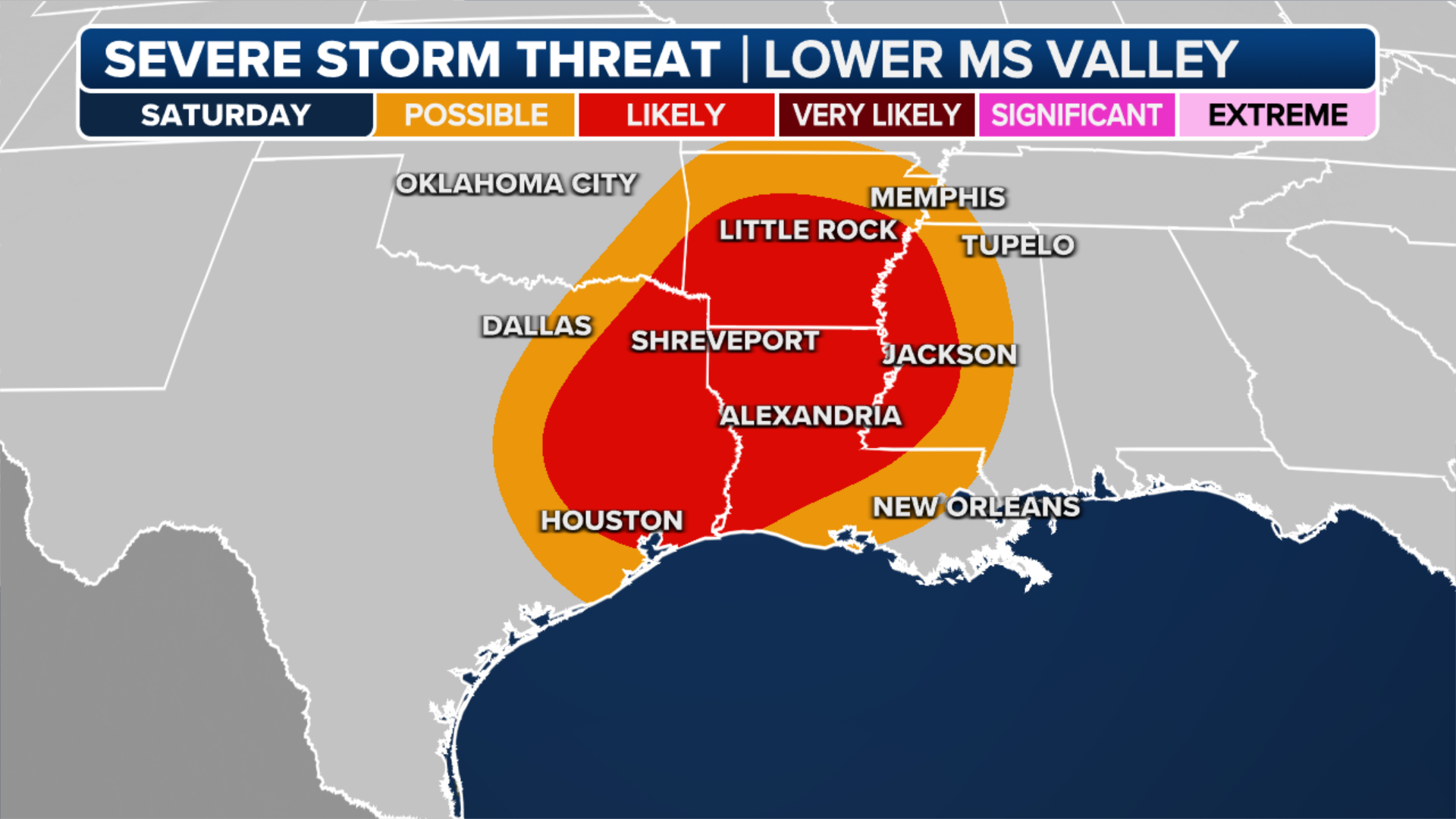
The FOX Forecast Center says severe weather is possible in the South from the storm system. The main threat appears to be from gusty winds that’ll happen both in thunderstorm activity and ahead of the advancing storm system.
A few storms may develop Friday night in parts of the Ark-La-Tex region and near the Ozarks as moisture streams into the region from the Gulf of Mexico.
By Saturday, the FOX Forecast Center believes enough moisture will be in place along with strong – the change in wind speed and direction with height – to result in the development of severe capable of producing some tornadoes, damaging gusts and from areas of East through , and .
has placed the region in a Level 2 out of 5 on its .
This includes the cities of in Arkansas, and in Louisiana and in Mississippi.
weather patterns are known to produce stormy weather across the Southeast, but so far, the last several storm systems have underperformed model guidance.
The was on November 20.
Snow expected in Midwest while heavy rain soaks the East
-
Image 1 of 3
The weather forecast in the eastern U.S. on Saturday, Dec. 9, 2023. ( )
-
Image 2 of 3
The weather forecast in the eastern U.S. on Sunday, Dec. 10, 2023. ( )
-
Image 3 of 3
The weather forecast in the Northeast on Monday, Dec. 11, 2023. ( )
The FOX Forecast Center says showers and thunderstorms will increase in coverage from the Gulf Coast to the Ohio Valley by Friday and continue into Saturday with windy conditions. The system will then continue to head east and reach the Interstate 95 corridor by the end of the weekend.
This means widespread rain is expected from the to , and winds could be whipping.
One of the main computer forecast models used by the FOX Forecast Center was suggesting that peak wind gusts by late Sunday in the tri-state area could exceed 55 mph, with isolated gusts between 60 and 70 mph not completely ruled out. However, given that the storm is still several days away from impacting the region, the predicted gusts could change as we get closer to the weekend.
FILE – A silhouetted walker made his way around Lake Harriet in Minneapolis, Minn. as falling snow obscured the horizon late Tuesday afternoon, February 22, 2023. (Photo by Jeff Wheeler/Star Tribune via Getty Images)
(Getty Images)
On the backside of the storm, cold air will produce snow from the central Plains to the Great Lakes.
However, the exact locations and snowfall accumulations remain uncertain and will become clearer as the week continues.
The FOX Forecast Center says wherever the band of snow sets up, there is the potential for up to 3-5 inches of snow through Monday.